
Maharashtra
MSRDC Invites Global Bids for GIS Development Plans Along Samruddhi Expressway
Sat Jul 25 2026
New Planning Exercise Aims To Drive Sustainable Urban Growth Around Samruddhi Expressway Interchanges
The Maharashtra State Road Development Corporation (MSRDC) has started a major planning initiative to support organized development along the Nagpur Mumbai Samruddhi Expressway. The corporation has invited global tenders to appoint an expert consultant for preparing Geographic Information System or GIS based development plans for areas surrounding the expressway's interchanges.
The move is expected to help Maharashtra plan future cities, industries, logistics hubs and public infrastructure in a scientific and sustainable manner. The project will focus on the influence areas around the interchanges on the 701 kilometre long Samruddhi Expressway, which has already become one of India's most important infrastructure corridors.
GIS Based Planning To Shape Future Development
According to the tender document, the selected consultant will prepare GIS base maps and carry out Existing Land Use surveys across the identified locations. Based on this data, the consultant will prepare detailed GIS based Development Plans for the areas around the expressway interchanges.
The exercise will create a digital planning framework that will help authorities manage future land use, road connectivity, public facilities and infrastructure development in a planned manner.
Urban planners believe GIS based planning allows governments to make better decisions by combining land records, transport networks, environmental data and future development requirements into one integrated system.
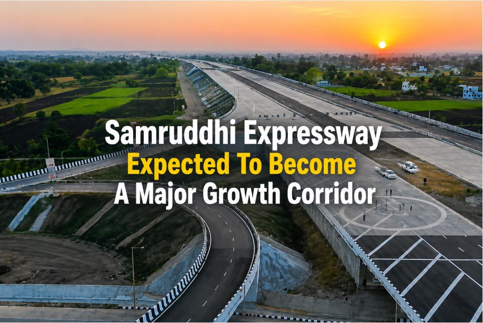
Samruddhi Expressway Expected To Become A Major Growth Corridor
The Nagpur Mumbai Samruddhi Expressway stretches for about 701 kilometres and connects several districts across Maharashtra. Since different sections of the expressway became operational, experts have highlighted its potential to attract industrial investment, logistics parks, warehousing projects and new residential developments.
MSRDC now wants to ensure that rapid development around the expressway follows a structured plan instead of unplanned expansion.
The corporation's latest initiative will support balanced urban growth while improving infrastructure planning and protecting long term development interests.
Recent reports have also highlighted the government's focus on developing economic clusters and integrated townships along the Samruddhi Expressway corridor. The new GIS based planning exercise aligns with this larger vision of creating well planned growth centres across Maharashtra.
Interchange Areas To Receive Detailed Planning
The Samruddhi Expressway includes more than 20 major interchanges. Each interchange covers an area of over 40 acres and serves as an important access point connecting nearby towns, industrial zones and state highways.
These locations are expected to witness higher commercial activity in the coming years. As a result, MSRDC plans to prepare detailed development plans for the surrounding influence areas.
The GIS based plans will help identify suitable locations for industries, residential projects, commercial centers, transport facilities, public amenities and green spaces while ensuring efficient land utilization.
Consultant Will Conduct Land Use Surveys
Apart from preparing digital GIS maps, the appointed consultant will carry out Existing Land Use surveys to understand how land is currently being used around each interchange.
The study will examine agricultural land, residential settlements, industrial areas, forests, water bodies and transport infrastructure. This information will form the foundation for preparing future development plans that balance economic growth with environmental sustainability.
Planning experts say such surveys reduce the risk of unplanned urbanisation and help governments allocate land more efficiently.
Tender Timeline And Submission Details
MSRDC has scheduled a pre bid meeting on August 12, 2026, at 3 pm at its headquarters located in Kohinoor Square, Dadar West, Mumbai.
Interested consultants must submit their online bids by 3 pm on September 15, 2026.
The tender also requires an Earnest Money Deposit of Rs 10 lakh from participating bidders.
The selected consultant will work closely with MSRDC to prepare comprehensive GIS based development plans that support future infrastructure and urban planning along the expressway corridor.
Why This Project Matters
The Samruddhi Expressway has significantly reduced travel time between Mumbai and Nagpur while improving connectivity across Maharashtra. As economic activity grows along the corridor, planned development has become increasingly important.
By preparing GIS based development plans, MSRDC aims to create a roadmap that supports sustainable urban expansion, attracts investment and improves infrastructure without placing unnecessary pressure on natural resources.
The initiative also reflects the growing use of digital planning technologies in large infrastructure projects across India. GIS based planning has become an important tool for governments to improve land management, support industrial growth and create smarter urban regions.
With this latest tender, MSRDC has taken another important step towards transforming the Samruddhi Expressway from a transport corridor into a well planned economic growth corridor that can support Maharashtra's long term development goals.